


Fire ravages eastern Hot Springs County
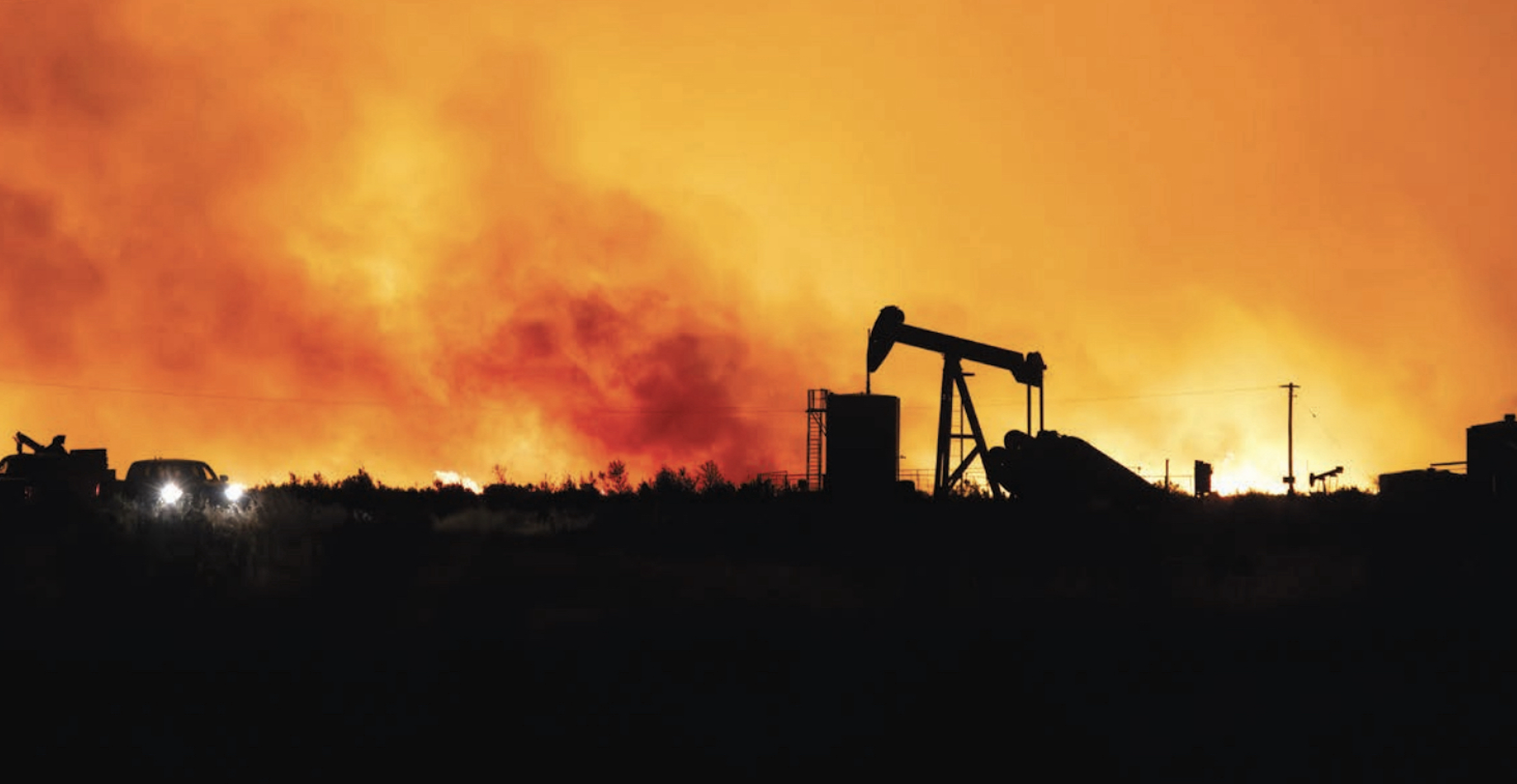
The Red Canyon Fire, which was started by lightning on August 13, is located approximately 14 miles east of Thermopolis. This picture was captured from an oilfield on Kirby Creek. On Tuesday, the fire was estimated at approximately 113,000 acres and 28% contained. Photo courtesy of Shaliee Harvey.
THERMOPOLIS — The Red Canyon Fire east of Thermopolis grew to more than 113,000 acres on Tuesday and is reportedly at 28% containment.
The Rocky Mountain Area Complex Incident Management Team Two took over command of the fire from Nevada Team 5 on Monday.
Thermopolis Volunteer Fire Department personnel responded to reports of smoke in an area 14 miles east of town on the evening of Wednesday, August 13, following a lightning storm that made its way through Hot Springs County. A small fire was located, and local firemen started suppression efforts, but the fire quickly grew to approximately 15,000 acres by the next day.
As additional response personnel arrived on scene, the Bureau of Land Management took over traffic control in the area, and road closures were announced on Black Mountain Road.
A wireless emergency alert, attributed to the Wyoming Office of Homeland Security, stated that residents were being asked to evacuate immediately due to fire. The alert failed to give a precise location, the Kirby Creek area, that was involved in the evacuation request.
The fire pushed in multiple directions due to erratic high outflow winds and jumped Kirby Creek Road and Buffalo Creek Road, causing additional road closures and evacuation areas.
High temperatures and low humidity contributed to the fire’s growth.
Evacuation zones were also established in Fremont County, and because of the fire’s close proximity to Washakie County, officials there are being included in incident reports.
Over the weekend the fire quickly surpassed 100,000 acres.
On Monday, Gov. Mark Gordon announced he had issued an executive order declaring an emergency in response to multiple fires currently burning in Wyoming. The declaration will help the state access additional federal firefighting resources and directs the Office of Homeland Security to take action to coordinate state and federal resources in response to the fires.
When requested, the Wyoming National Guard’s Adjutant General is authorized to activate National Guard members to provide support, pursuant to this executive order.
“Once again, wildfires in Wyoming are creating significant impacts on our communities and threatening lives and property,” Gordon said. “We will continue to ensure state resources are available to those affected by these fires.”
In addition to the Red Canyon Fire, the Spring Creek Fire near Ten Sleep has burned more than 3,500 acres and the Sleeper Ranch Fire near Meeteetse has burned more than 20,000 acres.
Fires continue to threaten private and public property.
Last Friday, FEMA approved Wyoming’s request for a federal Fire Management Assistance Grant authorizing the use of federal funds to help with firefighting costs for the Red Canyon fire. The authorization makes FEMA funding available to pay 75 percent of the state’s eligible firefighting costs under an approved grant for managing, mitigating and controlling designated fires. These grants do not provide assistance to individual home or business owners and do not cover other infrastructure damage caused by the fire.
Moving forward
The fire has continued to grow at an alarming rate, and RMCIMT2 is making a plan for how crews proceed.
It issued a Tuesday afternoon operations update which stated, “Temperatures are nearing 100 degrees today with low humidity, just as forecasted on the Red Canyon Fire. Winds remain steady and moderate, creating favorable conditions for firefighters in Div. G (northeast part of the fire) where crews are conducting strategic firing operations north of Bull Mountain and west of Pack Saddle Road. People may notice significant smoke in the area. While it can look like the fire is intensifying, this smoke is from planned burns. These operations are critical tools that reduce fuels and strengthen firelines, lowering the risk of the main fire spreading and protecting nearby communities and other values at risk.”
Firefighters added new division areas to the fire on Tuesday. They planned to continue to control the western edge of the fire, including an area with a hot edge with crews and engines. Crews will be mopping up and securing some areas on the southern edge of the fire to work to keep the fire from progressing into Fremont County in that area.
Along the southeastern and eastern edge of the fire, the management team will be bringing in crews and dozers to work on stopping the forward progression of the fire. They will also be doing some burnout operations in that area.
A Facebook page called Red Canyon Fire Information is the official fire information page and will have upto-date, accurate details. The Thermopolis Independent Record will be sharing those updates on its Facebook page.
This story was published on August 21, 2025.