
Network of observers help keep I80 open — or closed

By
Carol Ryczek with the Laramie Boomerang, from the Wyoming News Exchange

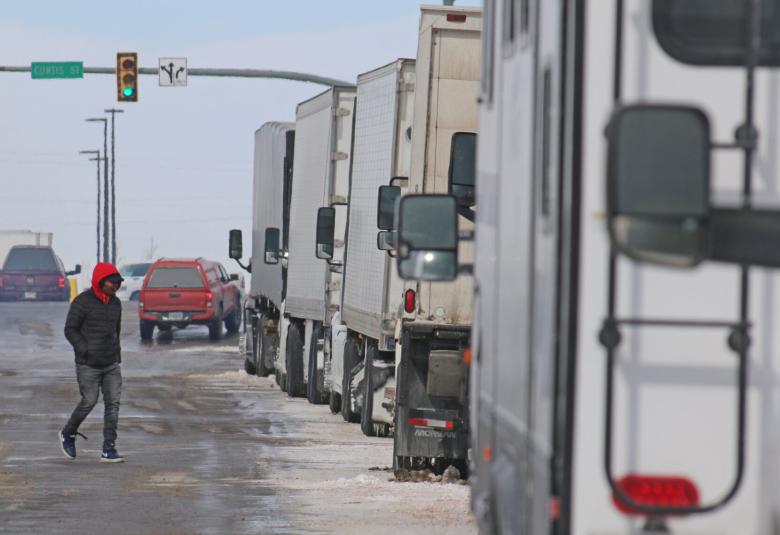
LARAMIE — Bright red lines across the Wyoming Department of Transportation mobile map quickly tell the story: Interstate 80 is closed.
Again.
The decision to close, and reopen, the interstate that crosses all of southern Wyoming is based on observations of DOT personnel on the interstate, said Doug McGee, spokesman for the DOT District 1 office in Cheyenne.
“I-80 is essentially a 400-mile mountain pass,” McGee said. “The highest point on I-80 in the U.S. is the top of Telephone Canyon by the Lincoln memorial. The average elevation of I-80 in Wyoming is about 6,200 feet. You’re driving a 400-mile mountain pass with sustained high winds, with sustained low temperatures and all that open prairie is full of snow. High winds can grab old snow, so on a clear day we can still have visibility issues.”
Blowing snow, new or old, creates pockets of very limited visibility, he said. But at what point does snow and wind mean the road is closed? Those recommendations come from DOT maintenance crews and members of the Wyoming Highway Patrol. Both groups operate under the DOT.
The state troopers and DOT crews make their observations based on years of road experience, McGee said. They report their recommendations to a supervisor who calls for the road to open or close. Calls are routed to a dispatch center in Cheyenne to share the information.
“We want the roads to stay open,” said Ed Leyba, a Laramie maintenance technician who serves as one of the plow drivers making recommendations. “We try not to shut it down. Traffic helps keep the road clean.”
Closures are never scheduled based on weather predictions, McGee said, but reflect the conditions on the road at the time. They are based on visibility, severe icing or drifting snow.
“Can the trooper actually see to the end of their hood?“ McGee offered as a rhetorical question that helps make the call.
Closures also are based on how well vehicles cope with the conditions. Crashes or vehicles sliding off the road can initiate a closure, not just because they are in the way of traffic, but because they’re indicators of what conditions are like.
High winds can mean the interstate is closed for lightweight or high-profile vehicles, McGee said. Semitrailer blow-overs are the most common. but tourists with trailers also may not understand the risk.
“There are days when it blows, 60, 70, 80 miles an hour,” he said. “An empty house trailer or camper RV will blow right over. It’s really up to the drivers to know their vehicle’s capability.”
When closures happen, barricades are placed in front of on-ramps or troopers block the entrance to the highway. State troopers also will help travelers find a way to safely get off the highway.
Sharon and Jim Musich of Woodbury, Minnesota, found themselves stranded in Laramie during a closure of I-80 on Wednesday. 

The couple was on their way to Salt Lake City and left Cheyenne that morning. They were already on I-80 east of Laramie when they saw a sign that the road had been closed.
“We couldn’t turn around. It got worse and worse,” Sharon Musich said. “Finally a state patrol (trooper) came by and told us there was a turnaround a quarter of a mile away. We followed a nice truck and got back here.”
The couple took a break at the Love’s Travel Stop in Laramie to wait out the closure.
“When we left Minnesota we were outrunning a snowstorm, and we made it until we got to here,” she said.
She added that their experience with travel in a cold climate meant that they had blankets, emergency rations and heavy clothes with them. They kept their gas tank full and let their family know where they were.
McGee also recommends that travelers download the Wyoming 511 app or map.wyoroad.info. Those mobile resources show the color-coded status of roads. As with stoplights, red lines mean “stop” and green means “go ahead.”
On some occasions, drivers will see a warning for a “rolling closure.” This means that although part of the route may be safe to travel, if there are closures near cities like Laramie or Rawlins, services like motels, parking and bathrooms may already be at capacity. In that case, the highway may be closed “upstream” from the disruption.
“We want to make sure that drivers have a safe place to wait,” McGee said.
McGee said department receives nearly constant feedback to any decision to close or open the interstate or other highways.
“We all answer the phones on a storm day or closure day,” he said.
Many of the questions come from out-of-state truckers who are unfamiliar with winter weather conditions and how variable they can be, he said.
“I get it. It’s disruptive to commerce. There is a same day/next day delivery culture out there,” McGee said. “But we will take a call from someone asking why we closed the road and then the next one will be from someone asking why we didn’t close down sooner.”
Shawn Chambers, owner of Connections Trucking Services, was one of the out-of-state truckers stranded in Laramie on Wednesday. As he looked ahead to 14-16 hours of closure, he said he made plans to stay in a motel.
The closures do have an impact on his bottom line, he said.
“Rooms, food, gas — everything costs more,” he said about having a layover. “Plus, extra fuel to stay warm.”
Chambers said he watches the weather closely but when his route takes him west, he has to take I-80.
“It all goes through Laramie,” he said.
 
This story was published on Feb. 27.

--- Online Subscribers: Please click here to log in to read this story and access all content.

Not an Online Subscriber? Click here to subscribe.


Sign up for News Alerts

Subscribe to news updates